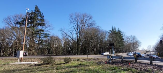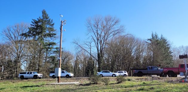
The TripCheck cameras overlook Spring Hill Drive and Highway 20. The Albany bridges are on the right.
One of these days, and probably soon, drivers will be able to check before they start out if there’s congestion on Highway 20 at the junction with Spring Hill Drive in North Albany.
ODOT has just about completed the installation of traffic cameras on a pole on Spring Hill, a few feet from the junction with the Albany-Corvallis Highway. The cameras are not yet turned on, but presumably that’s just a matter of time.
ODOT notified the city of Albany last August it would install the cameras and hook up the electricity to run them from the same box that runs the traffic signals at the junction as well as the bicyclist-on-bridge warning lights. The city pays for the power for those things.
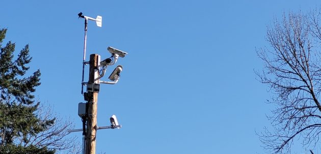
There are three cameras. One points south at the Willamette River bridges, one west at Highway 20, and one north at Spring Hill Drive.
The cameras will be part of the online TripCheck system of traffic cameras that extends all over the state.
I’ve sent messages asking ODOT for details about this TripCheck addition. I’ll pass the details on if and when I get a response.
All I know so far is that these are the only cameras to be installed on the Albany-Corvallis Highway, which has no others.
This approach to downtown Albany is often congested on weekday afternoons as Highway 20 commuter traffic from Corvallis and two roads from North Albany is funneled on to the two-lane Ellsworth Street bridge and the rigidly timed signals downtown.
Drivers should be able to time their trips to avoid the traffic jams after the cameras are turned on. (hh)

Traffic passes under the still-inactive cameras Friday afternoon.

There’s a wind vane above the cameras on top of the pole.

These cameras will be nice; but, I doubt that they will be a cure all.
Example – You, Hasso, do a trip check before you leave your house and find the bridges clear and Hwy 20 very light traffic.
You arrive at the light on North Albany Rd. and Hickory and the traffic is backed up on Hwy 20.
Conditions in this area can change at the drop of a hat and I, for one, will not rely on Trip Check.
I know that some will say you can use our phone while enrout – Not a safe or legal action if you are driving at the time.
ODOT TripCheck is integrated into WAZE.
https://www.tripcheck.com/Pages/Frequently-Asked-Questions
Why is ODOT using Waze data?
Waze is one of the largest “crowd sourced” traffic applications on the market. Adding Waze data to our authoritative data helps provide real time conditions and supplements information in areas where we don’t have devices on the road.
DIY’er? Develop your own app with the ODOT api-
https://www.tripcheck.com/pdfs/TripCheckAPI_Getting_Started_GuideV5.pdf
Gist of this is a safe, some day-autonomous, way to navigate the congestion is readily available.
But, it will never beat biking.
Pretty hard to avoid the bridge congestion. Not too many ways into go between North Albany and Albany shopping (unless you want to overpay at IGA).
All the result of thoughtless overbuilding without proper infrastructure.
I guess it’s a boom for Corvallis shopping, while handicapping Albanys.
So much for City Planning. Let’s say they got approval today to build a new bridge or add to the existing bridge.
How many years do you think it would take to finish?
How much worse will the traffic be then?
That’s if the city started today.
Gadfrey
Much angst over a minor delay that doesn’t rise to the level of minor inconvenience.