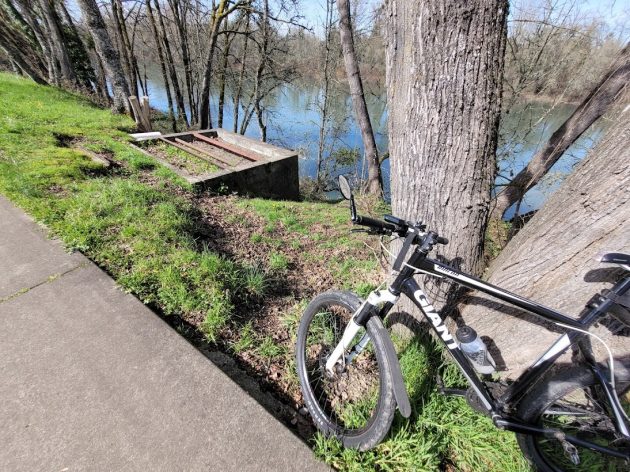
The mysterious concrete box off the Dave Clark Riverside Path on Friday afternoon.
It’s nearly two years since I wondered here about this box-like structure off the Dave Clark Path on Albany’s riverfront. I still don’t know why it is there or what its purpose used to be. But now I’m prepared to venture a hypothesis. And I hope somebody can tell me what it really was. (Somebody did; see the bottom of this story.)
When I wrote about this in August 2020, nobody I asked had any idea what function the structure might have served once upon a time.
This week, with time on my hands, I thought old maps might shed some light. Such maps — fire insurance maps published by the Sanborn company more than 100 years ago, are available in the Carnegie Library downtown. As luck would have it, the library was open when I went there to take a look.
This is one of the maps I checked:
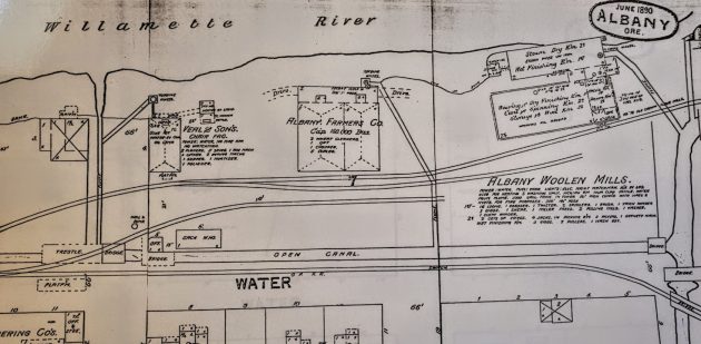
The map shows industries along the riverfront in 1890. Note the “open canal” paralleling Water Avenue, evidently fed from the Thurston Street canal on the right-hand side of the map.
Flumes are shown going from both canals toward the river. Near the bank, the flumes end in little rectangles the map labels as “turbine wheels.”
Could the concrete box near the riverbank today be what’s left of the housing for one of those turbine wheels? I’m not sure of this. For one thing, I can’t tell if the dimensions of the box, roughly 12 feet square, match any of the squares on the riverbank.
The box on the river today is near where Thurston Street would dead-end on the river if the street went that far. The street serves as the entrance to the Deluxe Brewing Company.
If this concrete structure has anything to do with Albany’s industrial waterworks of the late 19th Century, it would have been part of the Albany Woolen Mills there.
I can’t tell how deep down into the ground the concrete walls of that box reach. If they enclosed a turbine to provide power for the mill, they would have had to be quite deep, at least 20 feet or so.
Now the river side of the box gives no clue how deep it goes. The work of graffiti artists is all it shows. (hh)
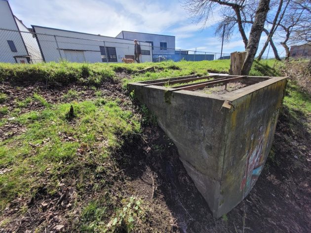
Here’s a look the mystery structure below the path, from the side facing the Willamette River.
Postscript: Well, my speculation about an historic turbine housing evidently was way off base. Gordon Steffensmeier of the Albany city engineering staff came up with photos, taken by a city employee, showing pipes extending into the river from the bank below this structure. This strongly suggests that the structure was the foundation of a pump house for taking river water up to the industry there. See the photo below.
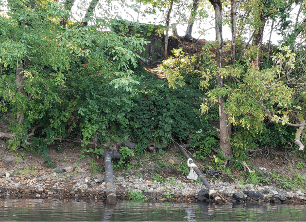
This is the photo showing pipes reach into the river below the concrete box.

The spray-painting troupe will be thrilled you referred to them as “artists.” Rarely does this accolade come their way.
Great research, Hasso, and an interesting map of yesteryear. The piece is historical, for a woolen mill to be onsite there. Perhaps the State Parks would have some info on the structure.
My husband and I always stop and wonder at that same thing! Thanks for possibly answering our question.
It is possibly the foundation for a pump house that drew water out of the river for industrial use. There are large abandoned water pipes going into the river just below this structure.
that’s plausible, do the pipes go down below the water line?
Yes.
I’m curious what the cement structure is that’s at Bryant Park back in the bike path wooded area. Any info on that??
I tried to find out in 2019. Here’s the story I wrote then: https://hh-today.com/todays-mystery-quiz-whats-that-ruin/
I have proposed many times to the City of Albany to put up signage along the Dave Clark River Path to identify old structures, historic sites and wildlife. Now during the “Water Front beautification” project it would be the ideal time to get this done.