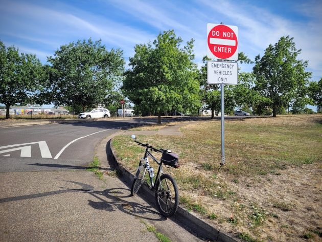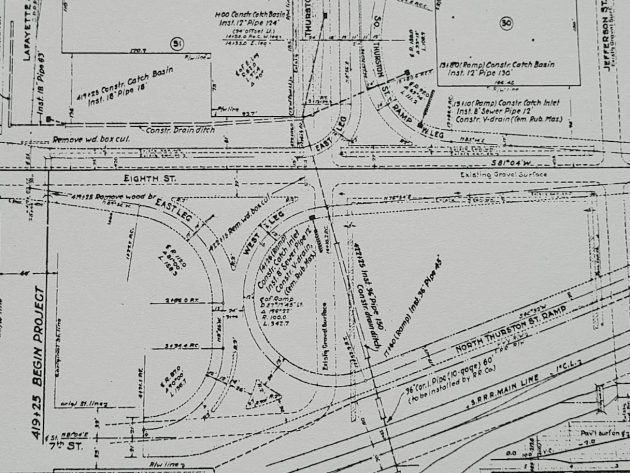
In 1939, the state Highway Department designed this as the west leg of the “North Thurston Street Ramp.” But ODOT closed it to the public about 25 years ago.
When the “Southern Pacific Railroad Overcrossing” in Albany was built in 1939, the state highway department provided it with proper ramps to get on and off. Many years later, ODOT made one of the ramps off limits. It’s still closed, and the question is why.
The closure happened, if memory serves, around the time ODOT built the Pacific-Ninth Avenue couplet in 1998. And the rationale is lost in the mist of what now seems like the distant past.
The Albany police had their station on Jackson Street at the time, and they needed this ramp for quick responses to the central and western parts of town. So the ramp closure has an exception for “emergency vehicles.”
Now that the police station is on Pacific Boulevard, that exception is unnecessary, except that Linn County deputies might still need it if they respond from the sheriff’s office to emergencies south of Albany.
When the ramp was still available to the public, Albany drivers often found it useful as they evaded long delays at the Queen Avenue rail crossing by heading north to cross the tracks on the overpass instead. Since they have been barred from that shortcut, drivers unwilling to wait have had to make a one-block detour via Hill Street to get on Pacific.
This was designed as the west leg of the North Thurston Street Ramp when the overpass was built. Here, take a look at the 1939 plan for this feature.

It was a perfectly workable design that served Albany drivers for many years, once upon a time. It could do so again if the traffic closure was removed. (hh)


One for emergency vehicles. Two because of too many traffic accidents. Now days so the Police can sit and conduct traffic stops as they see ‘em happening. Keep it closed…too many idiots on the road…don’t need ‘em pulling out in front of someone.
I agree, please reopen the ramp!
I have wondered the same thing for years!
That on ramp was part of a great route I used often until it closed. I would love to see it reopen. Queen is always a mess and it would relieve traffic to have this alternate route open.
That ramp changed sometime in the last 5+ years. I think it was right after the police station moved.
What was the speed limit and traffic volume in 1939 when that was designed? Not the same today and not a safe place to merge.
Keep it closed.
The reason to close the lane was because there was not a long enough lane to merge on to the overpass. Plus the school buses coming from the bus barn made it worse. ODOT wanted to close off the access from under the overpass and the council and ODOT finally agreed to keep it open for emergency access only. The buses were required to take Madison or Hill. Since the bus barn has moved then there is no longer that concern. But in my opinion, if it was reopened would create a safety issue to merge onto the overpass. There is a lot more traffic than 25 years ago!
Looks like if the merge sign was replaced with a stop sign then it would be a typical side street. Then drivers would have to wait for an opening just like other intersections.
Yet another reason to keep the area free of increased pedestrian and residential use. The area was designed well for the remaining few homes along with light industrial use to keep the traffic flowing. The restricted area was needed because it is typical for an on or off ramp to have heavier traffic during certain hours. Maybe that is why the police department was moved out of the area. Driving by the shelter is hazardous for regular traffic so when the emergency responders need to access 9th going towards I-5 it would be an obstacle course.
Did ODOT place the sign shown in the post?? The City Manager should instruct the new interim Albany traffic staff to request a sign change. Does ODOT really have the final say?
Sharon’s post indicates the Council agreed–so now Council action should disagree and demand change
Drivers are able to merge just fine from the exact same position on the other side of the overpass with even less line of sight. Either close that one too or open them both
The onramp on the south side has its own lane. You are not required to merge.
The reference was to getting on to Pacific from Ellsworth.