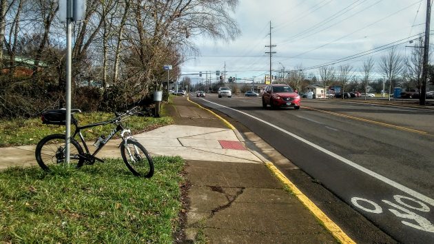
The Perwinkle Bikepath will be extended eastward from here, where it hits Queen Avenue, to Geary Street, where the signals are.
Albany has won grants totaling about $1.5 million intended to provide safer streets for children to get to and from two elementary schools on the south side of town.
The city council is set to accept the money when it meets Wednesday.
One of the projects, in the neighborhood of Sunrise Elementary, will extend the Periwinkle Bikepath for about one block east from there it dead-ends on the north side of Queen Avenue. The extension will create a multi-use path to Geary Street.
As part of the same project, “rectangular rapid flashing beacons” will be installed on Queen at Main and Thurston streets. People on foot wanting to cross Queen can activate the beacons, urging motor vehicles to stop and let them get across.
The path extension and beacons are estimated to cost about $289,000, of which the grant covers $239,000. Completion is expected in September 2021.
The other project , near Lafayette Elementary, calls for sidewalks to be built, in segments where there are no sidewalks now, on both sides of Geary Street between Grand Prairie and 34th Avenue. This will require some acquisition of right of way. (From looking at the street, it appears it may also mean cutting down a few big trees.)
Rapid crosswalk beacons will be added at 28th and 31st avenues.
The Geary sidewalk and beacon project, to be completed in April 2023, is estimated to cost $1.6 million. The grant is for $1,289,000.
In both cases, the city will use street system development funds to cover the difference between the grants and project costs.
Albany applied for the grants under the Safe Routes to School program administered by ODOT. As the name implies, the federal program is intended to improve conditions for school children who walk or bike to and from school. (hh)

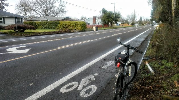
This section of Geary, south of 29th, is one of the segments that will get sidewalks by April 2023.


“….urging motor vehicles to stop and let them get across.”
Urging? That’s real comforting.
Hasso I think you better do some research. Periwinkle Creek path starts in Kinder Park and goes all the way to Grand Prairie Park. It just crosses Geary street, it does not dead end there. After crossing Geary it follows the creek through Periwinkle Park on on to grand Prarie Park. Clearly marked on maps.
I’m aware of where the path goes. My point is that in the middle, it dead-ends on Queen, and you either have to cross Queen there, or take the sidewalk, or ride the wrong way on the Queen Avenue bike lane to get to the intersection in order to pick up the path.
So I’m confused. What exactly do they want to do to connect the two paths? Build a bridge over queen?
Google Maps shows it starting on Hill St. just North of the Boys Club.
What research did you do?
Just north of hill street IS Kinder park. Look closer. Go out and look. You’ll see a sign erected in the park that shows where it starts. Google maps isn’t always correct.
Kinder Park is on the EAST side of OAK! Entrance at 14th.
The Boys Club is on the EAST side of HILL. Several blocks WEST of Kinder Park.
NONE of them are NORTH or SOUTH of those streets.
You can’t even keep your 4 major direction straight.
Well damn, as a kid growing up in S.E. Portland – Laurelhurst & Mt. Tabor -, sometimes I ran bare footed, drank water out of our water hose & walked to school along all kinds of streets. I had to watch out for myself! We were taught/told that back then. Geez, can you protect too much now & not make them responsible? DROP the phone & pay attention!
Well damn, as a kid growing up in 1950’s Miami, I did all the same things, including getting painfully zapped by a probably-ungrounded drug store refrigerator case (barefoot, of course).
Believe it or not, I agree with you about kids being overprotected — mostly when it comes to things like abduction by strangers, etc. But traffic hazards are a real and everyday problem that discourages parents from raising the “free-range” kids that both of us seem to favor.