
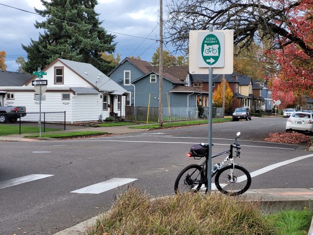
Here the designated Willamette Valley Scenic Bikeway (little green sign under the arrow) turns north on Main Street from Second Avenue. (Photo taken in November 2023.)
The Willamette Valley Scenic Bikeway goes through Albany, as you might expect, but on a convoluted route. Cycle Oregon proposed an improvement, but the suggestion has been turned down.
Cycle Oregon says this is the first officially designated bikeway in the United States. Following mostly county roads and city streets, the route covers 135 miles from Armitage Park in Eugene to Champoeg State Park near St. Paul.
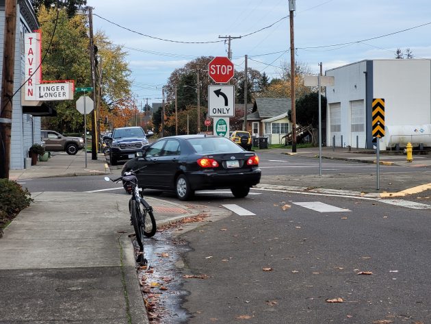
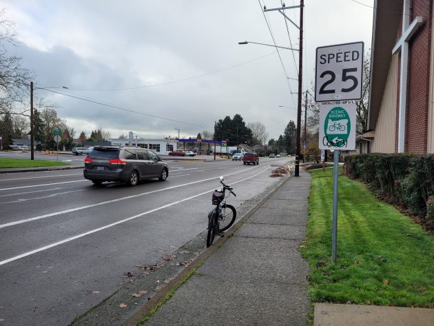
You can follow those little green “scenic bikeway” signs through the middle of Albany. From the south, the route comes in on Riverside Drive, goes east on Second, turns left on Main then right on First, turns right again on Geary, crosses Albany’s busiest intersection at Geary and Highways 20 and 99, keeps going south on Geary, turns left on Grand Prairie, crosses the freewway and turns north on Kennel Road on its way to Scravel Hill and Jefferson.
Nothing scenic about that.
Cycle Oregon proposed to cut out all that zig-zagging on high-traffic Albany streets. According to its proposal, northbound riders would turn left on Lyon Street, cross the Willamette and go out Spring Hill Drive on their way to Independence and Salem.
This was the plan last November, when Richard Hughes, a volunteer for Cycle Oregon, told me about it. This week I heard from Hughes again.
In an email he wrote: “The proposal to redirect the route from Albany north through Polk County was rejected by their county engineer. Therefore the existing route remains intact.”
This is hardly earthshaking news. I can’t remember ever seeing what looked like a bicycle tourist following the “scenic bikeway” sections downtown or in southeast Albany.
My guess is that long-distance riders look at maps. They’ll see on their way north, the route through North Albany and then Polk County, or vice versa if going south, is more direct. And probably more scenic too. (hh)
Believe it or not, the northbound Willamette Scenic Bikeway goes south on Geary and turns left here, on Grand Prairie. Photo is from December 2013.
Here, the bikeway turns right on First Avenue from Main Street. Then it turns south on Geary.
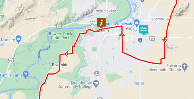
This is the Albany segment of the Willamette Valley Scenic Bikeway, from Cycle Oregon’s map.

I thought Cycle Oregon came to an end? Did it start up again?
The organization continues. It still organizes events, though not the big annual ride it used to put on.
Thank you.
If it went the way being suggested it would bypass almost all of the potential businesses that are dying to grab the cyclers dollars in Albany. We can’t have that.
The alternative would be awesome if shoulders on SpringHill were a bit wider. It’s a bit dicey on a bike getting out to the turn to Buena Vista. Perhaps better now that fewer trucks are using SpringHill to avoid Ind.Hwy & Hwy 20 intersection.
I think a bigger hazard than Springhill is using Riverside Drive rather than Oakville Road. There seem to be a lot more accidents on Riverside.
Referencing Abe Cee’s comments, yeah just think of all the tourist dollars that will be spent in downtown, primarily two second hand stores and they can get their front wheel alignment at Snyder’s, What a deal.
Nothing like a sign showing you to bike the wrong direction when the other sign shows a one way street.
East of Main Street Geary is two way. West of Main on Geary it is one way.
I’ve ridden all the area being discussed, bike commute to Tangent, and live on Springhill outside city limits. I hate ridding Springhill. So narrow and blind corners. Riverside is similar in many spots but a little less traffic.
I guess Scenic is the word to define and weigh against safety. Hwy 20 to Jefferson, even with having to time the bridges, is faster and is still fun with mostly wide shoulders and see countryside.
Agree with others above. We rode 101 south in May. Same issues on areas they took you off 101. Seemed more to see the businesses and off good shoulders…not necessarily safer.