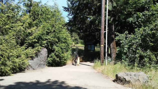
The entrance to the Cox Creek Path on Waverly Drive, June 4, 2020.
From the Cox Creek Path, you don’t see the creek for which it is named, especially not late in the spring when the vegetation runs wild.
Still, this is a nicely paved little path, about a third of a mile in length, between Waverly Drive near Simpson Park on one end and Salem Avenue and Waverly Lake on the other.
If you’re looking for an easy walk, you can park on the Simpson Park lot, stroll to the other end of the path, circle Waverly Lake, and get back to your car in, probably, half an hour or less.
Judging from the maps, Cox Creek forms the city limit between Albany and Millersburg. So while the path, on the creek’s north side, is technically in Millersburg, it’s part of the multi-use path system built and maintained by the Albany Parks Department.
In case you’re not familiar with the place, take a four-minute tour with the video below. (hh)


Next time, could you use a tracking app on your phone and also post a screen capture. It would show exact where you rode. Thx
Thanks for the reminder. I’d forgotten about that path, haven’t been down it for years. I liked how I could hear all the birds in the background. Very peaceful until you hit Salem Ave.
There are numerous cities named Albany throughout the country maybe next time you could reference the state. As a native of Albany New York I was perplexed beyond belief that there was something in my midst of which I was completely unaware. After a little investigation online I was relieved to learn but I did in fact you know my own backyard as well as I thought and that the Albany in question was not my Albany. Lol
The byline of the article says “perspective from Oregon’s mid Willamette valley.” That pretty well references the state…