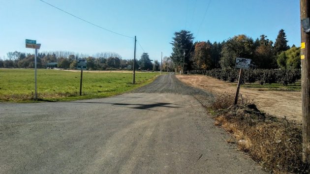
The entrance to Bowers Rock State Park is at the far end of that gravel road ahead.
The weather on Halloween was perfect for a short bike ride into the country, the object of which was to check whether there was anything new at Bowers Rock.
Through all that wind noise on the mike, you may have heard me say “hazelwood.” What I meant was “hazelnut,” of course.
Well, at the conclusion of this little video interlude I unclipped from the pedals and headed down the westward extension of Bryant Way, recently covered with a new layer of loose rock, to the entrance of the park.
(No fun slipping on shifting gravel and toppling sideways with your feet locked to the pedals. But, in case you care, I managed to stay upright.)
So, what did I find at Bowers Rock? Besides the gorgeous scenery and ponds, glittering in the autumn sun, I found the landscape changed a bit.
I’ll show you the pictures in a day or two, but first I have to look up a couple of facts. (hh)

Do you ever run into problems with the neighbors? Even though there’s an easement on the road to allow access to the park, the neighbors do not respect it. Last time I went on my bike one of the neighbors accosted me (literally swerved his car in front of me) to make sure I knew I wasn’t welcome. It really turned me off to the place in general and I haven’t been back since, which I guess was his intention.
Lovely people, when will they learn. Cameras are really inexpensive nowadays. Cops don’t even argue with video evidence. Guess I will keep it on when I travel down that path! Thanks for the heads up.
I owned the property on the right as you go down the road for over 40 years and there is no public easement, only the easement that Kleinke had to his property which included the parcel to the left of the road which wasn’t sold to the state. I can assure you that the state will have to go through many legal problems to access the site for public use. The road is only a 30’ right of way with 15’ coming from each property. Try to subdivide your property with a 30’ easement and you will find it is impossible so the state will have to use eminent domain to obtain public access as neither front property will sell a 60’ right of way.
BTW, I beat you to it. I went all the way to the where they are connecting the waterway to the Willamette. I met the head engineer and his family. All the workers out there seem pretty proud of there work out there. The engineer was very friendly and informative.
The path is pretty rough, one little test tube run (that I walked my bike). I suspect it will be beautiful if that path stays intact. I understand the property owners concerns. I assure you, us bikers are the least of their worries.
So,
Nyman contributes a jewel
If I understand, the road easment consists of easements on two properties so one owner has access to his/her property.
Is there a defined easement ( on the two properties) for access to the park?
Perhaps the answer man could poll his contacts.
I covered this in a story a year or two ago. State Parks relies on a 1917 deed that dedicates a perpetual 30-foot access easement across a number of properties, an easement granted by Hubbard Bryant, the original owner of that acreage.
So I am not trespassing even though all the signs say closed?
I’m sure you’re right about the easement but the state is wrong that they can use the easement for public use. The 30’ roadway was generated by quitclaim in 1947 to be a public road. However, the county would not accept the quitclaim in about 1980 give or take 5 years and refused to maintain the road saying it wasn’t a public road as the residents tried to get the county to maintain the existing asphalt road. The owner of the property has all the documents that apply to the road and believe me it is a mess.
Ahh, more clarity from Nyman.
So, the question is whether the State-related easment is still enforceable.
Lawyers at Dawn!!!!!