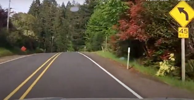
This is a curve advisory speed sign on OR 34, and ODOT says it wants to upgrade signs like this between Waldport and Philomath starting in 2021. But how will they keep this change from giving drivers the wrong idea?
If you’re like most drivers, experience over many years has taught you that the speed the signs advise can safely be exceeded by about 10 miles per hour.
Here’s what ODOT says: “Because many curves have posted advisory speeds that are lower than the current standards for safe driving, drivers often do not follow them. Instead, drivers travel five, ten, or more miles per hour over the posted advisory speed.”
The transportation department explains that the Federal Highway Administration has required that all curve signs meet current standards, and 50 percent of such signs in Oregon don’t.
“This is,” the agency says, “because of outdated technologies used in initial curve analysis, changes in driving habits, improvements in vehicle safety features, and inconsistent curve advisory speed changes that have happened over the past several decades.”
So now, the new signs presumably will account for all this and advise us that we can drive faster and still get around those curves.
You can see the problem. Drivers accustomed to the current signs will assume that safe speeds are still about 10 mph faster than whatever the signs say. So how many cars are going to fly off the road in the curves or slide into the opposing lane?
ODOT must have thought of that. And maybe they have a way to prevent problems once the new signs are up. You can see it now: “Arrow/50 mph/WE MEAN IT!”
By the way, ODOT has budgeted $1,589,400 for the curve sign upgrades on this road and on OR 229 farther north in Lincoln County. The work is to be done next year and in 2022.
The illustration for this story is a screen grab from a video I shot in 2018 after the road between Philomath and Waldport was declared a “scenic byway.” (You can read it and see the video here.)
I’m on that highway fairly often and can’t wait to see what the new curve signs will advise once they are installed. (hh)

Dangerous Curves……’nuff said. But seriously don’t we still have “The Basic Rule” road surface, weather conditions etc. Or as the rock band The Police said “we’re all contestants in a suicidal race.” Driving is dangerous and one should drive conservatively on any unfamiliar road until you learn the road. A better day is coming when driverless cars will solve all our problems because – as we now know – Once we turn our fate over to computers and software everything will be peachy. I digress.
A better day is coming when driverless cars will solve most of our problems. Period. Because our error rate, stupidity rate, and tendency to fall asleep on the job are far worse than that of well-designed and tested computer software and hardware.
There is a theorized problem with driverless cars having no direct connection to safety — owners having their cars continuously cruise around when there is no parking available. Solvable (like so many things) with congestion pricing.
By the way, I’ve driven the curvy part of 34 (east of Marys Peak Road) — very bad westbound at a time of dark shadows and extreme light/dark contrast. Too afraid of traffic behind me to go slowly enough to see reliably. Stopped at every possible turnout to let maniacs pass. Night (eastbound) was much better.
Thanks Hasso for the update!
I learned to drive on those curves, as a teenager. Once I mastered those curves I gained confidence and lost a lot of my fear. But what was my dad thinking starting me out on that road?