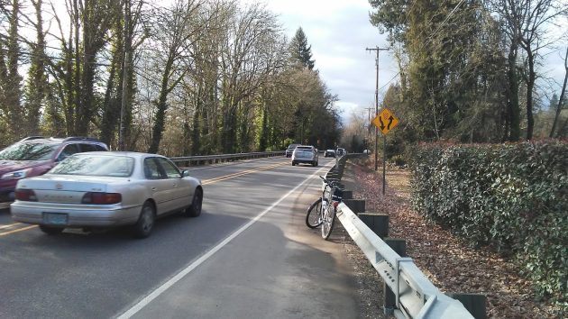
West of North Albany Road, Highway 20 looks the same as it did in January 2017, when this photo was taken. Improvements here won’t happen until an unspecified point in the future,
This week ODOT plans to start construction of safety improvements along the Albany-Corvallis Highway, and when I looked at the plans, I was surprised to learn that despite appearances to the contrary, the long-delayed Albany-Corvallis bikeway is not completely dead.
At the intersection with Independence Highway, for example, one element of the state plan is this: “Building a short section of multiuse path above a new 20-plus-foot-high retaining wall … for forward compatibility with the planned Benton County Bikeway.”
That work is part of Phase 1 of the Highway 20 safety upgrades to be accomplished starting now and continuing through August 2023.
Closer to Corvallis, ODOT says on its project website: “Replacing sidewalk with a short section of multiuse path on the east side between Conifer Boulevard and NE Pilkington Avenue for forward compatibility with the planned Benton County Bikeway project currently in development.”
That is part of Phase 2, which is supposed to start construction in 2023.
Highway 20 improvements close to Albany, from North Albany Road to Scenic Drive, are relegated to the unspecified “future” in ODOT’s plans. The main idea here is to add a center left-turn lane and widening the shoulders, but there’s no identified funding for final design or construction.
As for the bikeway portion of the project in this indefinite future, ODOT says it’s being coordinated with Albany and Benton County.
The Albany segment of the bikeway –from the end of Hickory Street to West Thornton Lake Road and Scenic Drive — hit an unbridgeable rift when the Union Pacific denied permission to cross under its trestle at Rainwater Lane. As an alternative, city transportation official Ron Irish told the Bicycle and Pedestrian Advisory Commission in October, planners were thinking of maybe routing the path along Rainwater to the highway. But then what?
Of course the main point of the Highway 20 safety improvements, costing an estimated $28 million, is not to encourage bike traffic between Albany and Corvallis but to reduce automobile crashes.
To that end, big changes are planned as part of Phase 1 at Independence Highway and Granger Road.
At both T-intersections, where it’s dangerous when traffic it’s heavy to turn left toward Albany, ODOT is adding a protected acceleration lane for Albany-bound traffic. The drawing below, taken from the ODOT website, makes clear how this will work.
In the meantime, though, ODOT says the work will cause occasional lane closures and delays of up to 20 minutes. (hh)
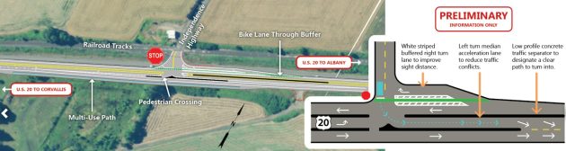
The ODOT drawing shows changes planned on Highway 20 at Independence Highway.

Sounds like ODOT is listening and trying to get a little ahead of what might be coming.
I guess now people can complain about ODOT doing that…
Thanks for this story. Out of all the stories that you post, this is the most important. We make it difficult to ride on bicycles on every aspect from infrastructure to safety. Traffic on HW 20 would be greatly reduced with a viable bike path. Union Pacific management is feudal and living in the days of the pioneers. Here, the company has an opportunity to do great good in Benton and Linn counties and provide a huge impact on the lives of thousands of people but they choose profits over people. Mind-boggling.
Hasso – thank you for this update. ODOT is trying to ensure safety at the cost of cutting off Midway Farms access. After a meeting last night at Midway there is no resolution – ODOT refuses to build a new driveway for this small business. It is sad, but who can fight ODOT? I would like to know what Phase II will be since there are a lot of homeowners in the way between the park and Albany. ODOT is not an information sharing friend and they love to use eminent domain.
This is all good unless they take your front yard. I agree on the railroad though, if they could keep the path on the railroad side it would mean only crossing Hwy 20 once – on the river side it takes from landowners and you will have to cross the Hwy twice to get to the end of the Albany path at Scenic Drive. The plan could be a little dangerous for bikers and pedestrians.