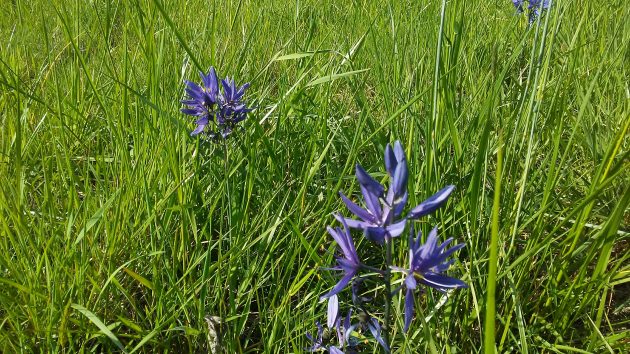
Today’s comment by Tom Cutsforth — on the story about the HIP construction, below — sent me back on the road to check out the flowering camas in the meadow south of the former Bureau of Mines. The result, such as it is, you see here.
Now, of course, the property belongs to the National Energy Technology Laboratory of the U.S. Department of Energy. You can see some of the lab’s buildings in the background of this shot:
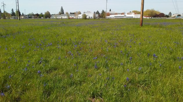
In the distance, the blossoms of the camas plant, delicate and lovely as they are close up, are growing too far apart to produce more than a light blue haze on the ground when seen through a smartphone’s camera.
The field has remained undeveloped for decades, and there are still no-trespassing signs in various places. No doubt this contributes to the myth, referred to in the reference to a “Superfund” site in Tom’s message to me, that the soil is contaminated as a result of research at the Bureau of Mines decades ago.
Over the years, federal authorities have conducted repeated evaluations and cleanups of the government’s Albany property and surroundings. They concluded there is no remaining hazard. You can read a summary here.
You can bet that if the government really needed to keep people off that land because of concerns about making anyone sick, the meadow would be surrounded by an 8-foot fence topped by razor wire. Instead, at least on the east and south sides, all there is are three or four signs to stay off this piece of federal land.
As for the turkeys mentioned in Tom’s report, I didn’t see any this Wednesday afternoon. But I’m grateful that he pointed out the flowering of the camas, which gives a pleasant springtime hue to this Albany site. (hh)
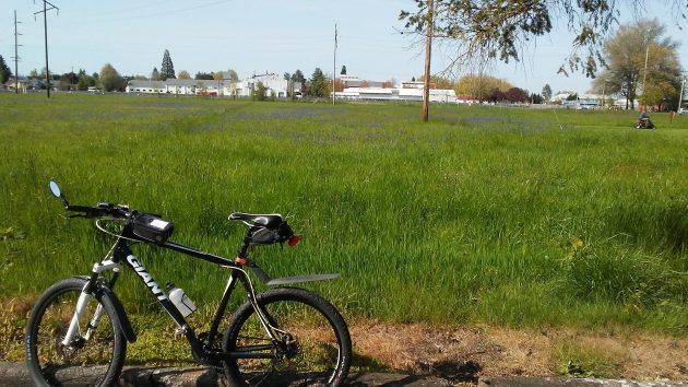
Looking at the site from the parking lot of the Albany Tennis Club.

H.H..for years the Albany site would collect the leaves from it’s many trees and dump them at the south edge in that very field. People would then go by & gather a bunch for compost. Wonder if anybody told the Feds that for years those leaves (possibly with contaminants) have been placed at any number of Albany locations??
Tangential connection to “camas.” I’m 70. My great-grandfather & wife arrived in Cottonwood, ID in 1887. He owned/ran “Kopczynski Iron Works.” (He was a blacksmith.) It’s on the edge of “Camas Prairie” – near Grangeville, ID. He raised 12 children. My grandfather grew up in Cottonwood. My parents were also raised there. Much of the family stayed there. Camas root was a well known plant & food commodity for sure!