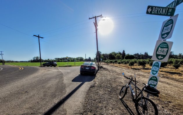
This corner of Bryant Way and Bryant Drive is where people customarily park before walking to the entrance of Bowers Rock State Park.
In the June 29 story on Bowers Rock State Park, I left you hanging. I said I would pass on any news regarding that undeveloped state park west of Albany if I heard from the Oregon Department of Parks and Recreation.
I did hear back, but on the question of easier public access, there’s little to report.
Sarah Steele, Willamette Valley district manager for Oregon state parks, got back to me on July 5.
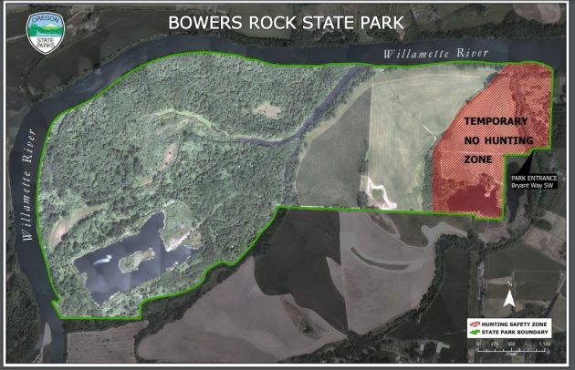
She reported that the department had established a safety zone at Bowers Rock “to help protect the neighbors. promote public safety, and to reduce noise and target complaints.”
Apparently there had been complaints during hunting season of stray shot landing in neighbors’ yards and on houses, as well as trespass complaints.
“This will provide users peace of mind that there is a location that is safe for them to recreate during hunting season by focusing hunting activities in and around the third pond,” Steele wrote in an email.
She sent along this map of the safety or no-hunting zone, which is near the entrance at the park’s east end.
As for easier access, the answer remains what it has been for years: They’re working on it.
The only way to access the park is to walk or bike about a quarter mile along a private, rock-covered road — the western extension of Bryant Way — from the corner where Bryant Drive begins.
“We are still working with local partners to better understand how best to provide safe parking,” Steele wrote in her email.
Things to consider are the wintertime flooding of much of the park, protection of farm fields near the park entrance, plus how to provide trails and signs to help visitors navigate the property.
“We have been exploring concepts on how best to integrate all of this along with safe parking while being mindful of the neighbor concerns, as well as having it be as sustainable as possible,” Steele wrote.
Come fall and winter, she added, they’ll be looking into this again. (hh)

The solution is simple. Just buy the parcel I owned for 40 years and the 5 acre parcel behind it which has no house and you now have access.
Perhaps if the City were to install a 24-hour/day web cam to capture the nefariousness, and used Facial ID software, then, with some good fortune, this problem could be eliminated.
Not in the City