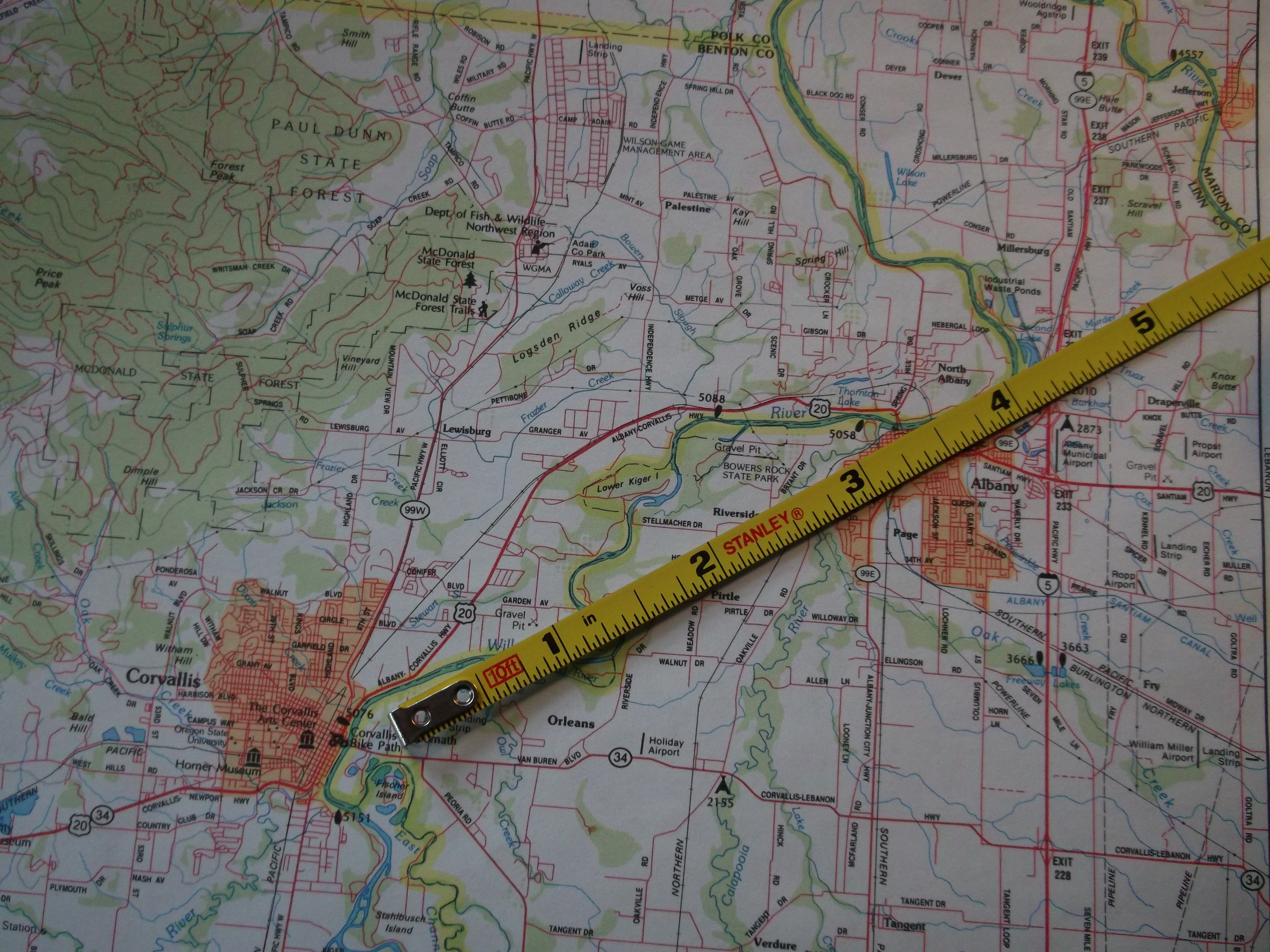
Only about 6 miles separate the outskirts of Albany and Corvallis.
Now that the latest plan for an Albany-Corvallis Bike Trail — or “multi-use path” — has been shot down, Benton County says it will try to find another route. A long look at the map suggests at least two alternatives that would be almost as good.
Benton County this week withdrew its request for $2 million in Connect Oregon funds after the county planning commission on Feb. 17 unanimously denied a conditional use permit to route the path through farm land along the northwest side of the PNWR railroad line. Now the county plans to try again, and this time to do things right.
Its next step is to select, in March or April, a consultant with experience in this kind of project to examine route options so they can be studied. The county also will have a schedule of meetings and other forms of public “outreach.” Six to 12 months later, the county expects to have a plan with strong public support. Then it will seek funding once again.
So what about possible routes, routes that don’t interfere with other uses and don’t run into Oregon’s strong protections of exclusive-farm-use land?
One would follow the previous plan on the north side of Highway 20 from Scenic Drive near Albany across Independence Highway to the vicinity of Granger Road. From there it would follow Granger west to Lewisburg, then turn south along the east side of Highway 99W until it meets an existing bike path at Circle Boulevard. The right of way along 99w should be wide eough to accommodate a path separate from the highway, similar to the path farther north, from Monmouth to Rickreall.
The other alternative lies on the east side of the Willamette River and is already being pursued by ODOT and Linn County. ODOT is extending an off-highway path along Oregon 34 from Wolcott Street, where it now ends, to Riverside Drive. And Linn County is planning to widen Riverside all the way from Albany to Highway 34 to accommodate a safe bike lane. It’s not the same as a separate path, but it’s better than what’s there now. Linn has started surveys and other preparations to widen the first 3 miles of this route, starting from Oakville Road, in 2016.
The Lewisburg alternative would be only slightly longer than the route along the railroad, but it would not interfere with the intensive farming along the tracks south of Granger. The Rverside option has the advantage of being more convenient for users from the Linn County portion of Albany.
On the map, another striking fact appears. The southwestern edge of Albany and the northeastern part of Corvallis are separated by only six miles. Several roads exist, little used and dead-ending at or near the Willamette. So, a narrow bike bridge across the river would solve the problem. Imagine the required permits for, objections to and astronomical expense of that! (hh)

Have I missed something or has something already been decided on a route from the north end of the bridge/s in N. Albany to Scenic Dr.? Hwy 20 from N. Albany Rd to Scenic Dr seems to me to be the most hazardous of distance from Albany to Corvallis. If this stretch hasn’t been decided on it should be included in the plan from the start, not come as an “Oh yes, we need to do this too.”
Yes, the stretch from Spring Hill to Scenic has been decided on, though to what extent rights of way have been secured I’ll have to check. (hh)
I think the most hazardous part extends another mile west from Scenic Drive to Hyak Park – very narrow shoulders and fast traffic. You have the choice of Thornton Lake Drive to escape the whole mess east of Scenic Drive.
If Eugene can have 5 bike/pedestrian bridges across the Willamette, why can’t we have one? Because the river is wider here? Not really.
To make an apples-to-apples comparison, I measured (using Google Maps aerial photos) the shortest possible distance between shorelines close to each bridge. From northmost bridge to southmost, the 5 Eugene distances are 330, 365, 250, 465, and 315 feet.
There are 2 obvious bridge crossing spots here. At the west end of Stellmacher Drive, the comparable distance is less than 350 feet, more likely 320. Connecting Walnut Drive with Garden Ave via Strawberry Lane, it’s about 250 feet.
From the Strava heat map, it looks like Riverside Dr. is the more popular route (for Strava carrying cyclists – a type of GPS software, ) http://labs.strava.com/heatmap/#12/-123.19112/44.59253/blue/bike
Personally, I feel safer on Hwy 20 than 34, and the road seems cleaner. I really like the idea of a separate path if it is in anyway pragmatic.
Thanks for keeping your readers up to date on this.
Thanks for the link. I’m certainly going to spend hours there ;-). Some problems with the map are discussed at http://engineering.strava.com/global-heatmap/ and there is no indication of sample size, but it’s still very interesting.
My feeling about 20 vs 34 is that 34 is so ugly, dirty, noisy, and unpleasant that I almost don’t care that I feel less safe on 20’s narrow shoulders. When the path along 34 is finished to Riverside Drive, I’ll probably seldom use 20.
If there were ways to get totally away from busy highways, like the bridge idea, I’ll bet more people would try bike commuting.